Walking from Kiyomizu-dera Temple to Heian-kyō

in Kyoto, Japan

2.03 km
27 minutes walking
AB
Kiyomizu-dera Temple
AKiyomizu-dera TempleWikidata ↗
BHeian-kyōWikidata ↗

Standing at Kiyomizu-dera Temple, you’re immediately surrounded by the scent of cedar and the faint sound of temple bells ringing in the distance. The air is crisp, and the view of the city below is dotted with cherry blossoms, their delicate fragrance hinting at spring. You can hear the rustling leaves and the soft chatter of visitors as they admire the temple's wooden stage, which seems to float above the landscape.

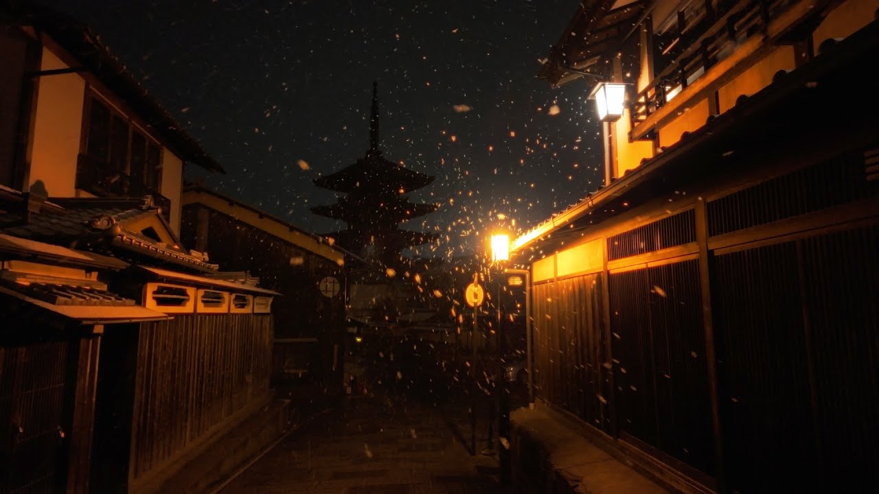
As you step away from the temple, you’ll wander down Kiyomizu-zaka Street, lined with traditional shops selling pottery and sweets. The cobblestone path slopes gently, and you might hear the clatter of wooden sandals against stone. Following the street, you’ll reach the more residential areas of Sannenzaka and Ninenzaka, where the narrow lanes become steeper and the buildings grow closer together. The atmosphere shifts from the touristy vibe of the temple to a more local feel, with the occasional waft of grilled street food filling the air.

Keep an eye out for the uneven cobblestones on the steeper sections of Sannenzaka - they can trip you up if you’re not careful. Traffic can also be unpredictable, especially when crossing roads that lead into busier areas. While scams aren't rampant, it’s wise to be cautious of overly friendly strangers offering unsolicited help. Most shops and restaurants will have varying opening hours, so check ahead if you’re planning to stop.

A good pair of walking shoes is essential for this route, as the terrain can be uneven and steep in parts. Bring a bottle of water, especially in the warmer months, and consider sunscreen or an umbrella depending on the season. If you're walking in the morning or late afternoon, the golden light filtering through the trees can make your stroll even more pleasant.

The best moment comes as you approach the entrance to Heian-kyō, right around dusk when the lanterns begin to light up. You’ll see the tranquil reflection of the garden in the pond, with the soft sounds of water lapping against the stones. The air is cooler, and the scent of blooming azaleas drifts gently, marking the end of your journey beautifully.

Turn-by-turn directions

16 steps · pace ~4.5 km/h
  1. Set off
    35 m
    28 s
  2. Take a left
    121 m
    2 min
    0.16 / 2.03 km · 8%
  3. Take a left
    46 m
    37 s
    0.20 / 2.03 km · 10%
  4. Take a left
    48 m
    39 s
    0.25 / 2.03 km · 12%
  5. Road becomes 清水坂
    222 m
    3 min
    0.47 / 2.03 km · 23%
  6. 💧First quarter done. If it's hot, a sip of water now beats a gulp later.
  7. Road becomes 清水道
    175 m
    2 min
    0.65 / 2.03 km · 32%
  8. Continue as the road bends
    227 m
    3 min
    0.87 / 2.03 km · 43%
  9. 🏁Halfway. Good moment to refill water or grab a quick coffee if you see one.
  10. Take a left
    303 m
    4 min
    1.18 / 2.03 km · 58%
  11. Turn slight right onto 松原通
    160 m
    2 min
    1.34 / 2.03 km · 66%
  12. 🪜Three quarters. Legs may start protesting - the next bench is fair game.
  13. Hang a right
    205 m
    3 min
    1.54 / 2.03 km · 76%
  14. Hang a right
    29 m
    24 s
    1.57 / 2.03 km · 77%
  15. Continue as the road bends
    142 m
    2 min
    1.71 / 2.03 km · 84%
  16. Turn left at the end of the road
    85 m
    1 min
    1.80 / 2.03 km · 89%
  17. 📍Almost there. Look up - you should be able to spot the destination soon.
  18. Turn right at the end of the road
    103 m
    1 min
    1.90 / 2.03 km · 94%
  19. Take a left
    Final stretch. Slow down so you don't walk past the entrance.
    131 m
    2 min
    2.03 / 2.03 km · 100%
  20. 🏁
    Arrive at destination

Local-script names show how they're signposted. The ≈ line shows a rough Latin transliteration to help with pronunciation. Times assume a steady ~5 km/h walk; add 15-20% in summer heat, on hills, or in crowds.

Open in the planner Customise this route or add more stops →
See Kyoto street previews

Watch Kyoto streets before you walk

Ambient first-person walking videos of Kyoto. Same streets, real sound. Pick a season or time-of-day to preview the route.

Watch Kyoto during the day
day · during the day
Watch Kyoto during the day
Watch Kyoto at night
night · at night
Watch Kyoto at night
Watch Kyoto in spring
spring · in spring
Watch Kyoto in spring

Other walking routes in Kyoto

Share this route

WhatsAppTelegramFacebookXRedditLinkedInEmail

Frequently asked questions

How long does it take to walk from Kiyomizu-dera Temple to Heian-kyō?

About 27 minutes at a steady 4.5 km/h walking pace. Add 15-20% in summer heat, on hills, or if you stop for photos.

How far is Kiyomizu-dera Temple from Heian-kyō on foot?

The walking route is 2.03 km following pedestrian paths. The straight-line distance is shorter but ignores buildings and one-way streets.

Is this walk suitable for casual walkers?

This 2.03 km route is an moderate walk - manageable for most people in normal shoes. The pedestrian path uses footpaths and side streets where possible, so it's safer than walking along main roads.

What streets does the route pass through?

The route in Kyoto passes through 清水坂, 清水道, 松原通. Street names are signposted in the local language.

What's the best time of day to walk this route?

For the best atmosphere on this stretch of Kyoto, the day walking video gives the most accurate preview of light and crowds. In general, early morning or sunset minimises midday heat and gives softer light for photos.

Is the walking route free?

Yes - planning, viewing the route, and using our directions are all free. Watch out for paid entry to any specific landmark on the route (museums, archaeological sites) - those are separate from the walk itself.

Can I reverse the route and walk from Heian-kyō back to Kiyomizu-dera Temple?

Yes - the same path works in reverse with the same distance and walking time. Some one-way streets only affect drivers, not pedestrians.

Walking pace assumed at about 5 km/h on level ground - hills, crowds, and stops will slow you down.

Walking-route geometry from OpenStreetMap contributors via FOSSGIS OSRM (data licensed under ODbL). Landmark data from Wikidata (CC0).