Walking from Kiyomizu-dera Temple to Ginkaku-ji Temple

in Kyoto, Japan

5.39 km
72 minutes walking
AB
Kiyomizu-dera Temple
AKiyomizu-dera TempleWikidata ↗
Ginkaku-ji Temple
BGinkaku-ji TempleWikidata ↗

As you stand at the base of Kiyomizu-dera Temple, the scent of incense wafts through the air, mingling with the fresh aroma of the nearby cherry blossoms. The wooden structures rise majestically before you, their intricate details catching the soft morning light. You hear the gentle rustle of leaves and the distant sound of a temple bell ringing, creating a serene atmosphere that invites you to begin your journey.

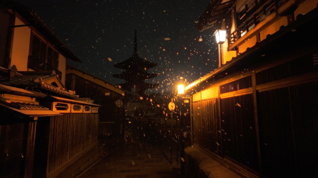
Leaving the temple grounds, you descend the narrow streets of Sannenzaka and Ninenzaka, where traditional wooden machiya houses line the way. The cobblestone paths are uneven underfoot, and the sound of your footsteps echoes as you pass by quaint tea shops and artisan boutiques. As you make your way toward the bustling streets of Sanjo-dori, the terrain shifts to a more urban feel with shops and cafes offering a variety of snacks. You'll notice the air changes too, with the scent of matcha and grilled yakitori filling your senses.

Watch your step on the steep cobbles as you navigate the winding streets. Be mindful of cyclists weaving through the crowds, and keep an eye on your belongings, especially in busier areas where pickpockets might be lurking. The shops along the way have varying hours, so if you’re hoping to stop, check ahead to avoid disappointment.

Wear comfortable shoes, as you’ll be walking over uneven surfaces, and bring a bottle of water to stay hydrated. Depending on the season, you might want a light jacket or an umbrella, as Kyoto weather can be unpredictable. If you start in the morning, you'll enjoy a quieter atmosphere before the crowds arrive.

The best moment comes as you approach Ginkaku-ji Temple, just after noon. The soft sound of a nearby stream and the rustling of bamboo leaves create a calming backdrop as you step into the temple's serene gardens. You pause to take in the carefully raked gravel and the reflection of the temple in the pond, the scent of moss and earth lingering in the air, marking the perfect end to your walk.

Turn-by-turn directions

36 steps · pace ~4.5 km/h
  1. Set off
    35 m
    28 s
  2. Take a left
    121 m
    2 min
    0.16 / 5.39 km · 3%
  3. Take a left
    46 m
    37 s
    0.20 / 5.39 km · 4%
  4. Take a left
    48 m
    39 s
    0.25 / 5.39 km · 5%
  5. Road becomes 清水坂
    222 m
    3 min
    0.47 / 5.39 km · 9%
  6. Hang a right onto 三年坂
    57 m
    46 s
    0.53 / 5.39 km · 10%
  7. Carry on along 三年坂
    158 m
    2 min
    0.69 / 5.39 km · 13%
  8. Hang a right onto 二年坂
    120 m
    2 min
    0.81 / 5.39 km · 15%
  9. Take a left onto 一年坂
    97 m
    1 min
    0.90 / 5.39 km · 17%
  10. Continue as the road bends
    352 m
    5 min
    1.26 / 5.39 km · 23%
  11. 💧First quarter done. If it's hot, a sip of water now beats a gulp later.
  12. Take a left
    114 m
    2 min
    1.37 / 5.39 km · 25%
  13. Carry straight
    69 m
    56 s
    1.44 / 5.39 km · 27%
  14. Take a left
    107 m
    1 min
    1.55 / 5.39 km · 29%
  15. Hang a slight left
    32 m
    25 s
    1.58 / 5.39 km · 29%
  16. Turn left at the end of the road
    49 m
    39 s
    1.63 / 5.39 km · 30%
  17. Take a left
    193 m
    3 min
    1.82 / 5.39 km · 34%
  18. Take a left
    322 m
    4 min
    2.14 / 5.39 km · 40%
  19. Turn slight right
    27 m
    22 s
    2.17 / 5.39 km · 40%
  20. Take a left
    279 m
    4 min
    2.45 / 5.39 km · 45%
  21. Turn right onto 六勝寺のこみち
    197 m
    3 min
    2.65 / 5.39 km · 49%
  22. 🏁Halfway. Good moment to refill water or grab a quick coffee if you see one.
  23. Turn left at the end of the road
    176 m
    2 min
    2.82 / 5.39 km · 52%
  24. Hang a right
    Use this stretch to catch your breath if the next turn looks busy.
    292 m
    4 min
    3.11 / 5.39 km · 58%
  25. Hang a right onto 二条通
    7 m
    6 s
    3.12 / 5.39 km · 58%
  26. Take a left
    202 m
    3 min
    3.32 / 5.39 km · 62%
  27. Hang a right onto 冷泉通
    19 m
    15 s
    3.34 / 5.39 km · 62%
  28. Take a left
    145 m
    2 min
    3.49 / 5.39 km · 65%
  29. Hang a right
    190 m
    3 min
    3.68 / 5.39 km · 68%
  30. 🪜Three quarters. Legs may start protesting - the next bench is fair game.
  31. Turn right at the end of the road
    Long stretch ahead - photo break, phone check, or just look around.
    667 m
    9 min
    4.34 / 5.39 km · 81%
  32. Continue as the road bends
    128 m
    2 min
    4.47 / 5.39 km · 83%
  33. Hang a right
    179 m
    2 min
    4.65 / 5.39 km · 86%
  34. Hang a right
    155 m
    2 min
    4.80 / 5.39 km · 89%
  35. 📍Almost there. Look up - you should be able to spot the destination soon.
  36. Take a left
    93 m
    1 min
    4.90 / 5.39 km · 91%
  37. Take a left
    Use this stretch to catch your breath if the next turn looks busy.
    306 m
    4 min
    5.20 / 5.39 km · 97%
  38. Hang a right
    138 m
    2 min
    5.34 / 5.39 km · 99%
  39. Turn left at the end of the road
    Final stretch. Slow down so you don't walk past the entrance.
    49 m
    39 s
    5.39 / 5.39 km · 100%
  40. 🏁
    Arrive at destination

Local-script names show how they're signposted. The ≈ line shows a rough Latin transliteration to help with pronunciation. Times assume a steady ~5 km/h walk; add 15-20% in summer heat, on hills, or in crowds.

Open in the planner Customise this route or add more stops →
See Kyoto street previews

Watch Kyoto streets before you walk

Ambient first-person walking videos of Kyoto. Same streets, real sound. Pick a season or time-of-day to preview the route.

Watch Kyoto during the day
day · during the day
Watch Kyoto during the day
Watch Kyoto at night
night · at night
Watch Kyoto at night
Watch Kyoto in spring
spring · in spring
Watch Kyoto in spring

Other walking routes in Kyoto

Share this route

WhatsAppTelegramFacebookXRedditLinkedInEmail

Frequently asked questions

How long does it take to walk from Kiyomizu-dera Temple to Ginkaku-ji Temple?

About 72 minutes at a steady 4.5 km/h walking pace. Add 15-20% in summer heat, on hills, or if you stop for photos.

How far is Kiyomizu-dera Temple from Ginkaku-ji Temple on foot?

The walking route is 5.39 km following pedestrian paths. The straight-line distance is shorter but ignores buildings and one-way streets.

Is this walk suitable for casual walkers?

This 5.39 km route is an longer walk - bring water and pace yourself. The pedestrian path uses footpaths and side streets where possible, so it's safer than walking along main roads.

What streets does the route pass through?

The route in Kyoto passes through 清水坂, 三年坂, 二年坂, 一年坂 and others. Street names are signposted in the local language.

What's the best time of day to walk this route?

For the best atmosphere on this stretch of Kyoto, the day walking video gives the most accurate preview of light and crowds. In general, early morning or sunset minimises midday heat and gives softer light for photos.

Is the walking route free?

Yes - planning, viewing the route, and using our directions are all free. Watch out for paid entry to any specific landmark on the route (museums, archaeological sites) - those are separate from the walk itself.

Can I reverse the route and walk from Ginkaku-ji Temple back to Kiyomizu-dera Temple?

Yes - the same path works in reverse with the same distance and walking time. Some one-way streets only affect drivers, not pedestrians.

Walking pace assumed at about 5 km/h on level ground - hills, crowds, and stops will slow you down.

Walking-route geometry from OpenStreetMap contributors via FOSSGIS OSRM (data licensed under ODbL). Landmark data from Wikidata (CC0).