Walking from Angel of Independence to Torre Latinoamericana

in Mexico City, Mexico

3.31 km
44 minutes walking
AB
Angel of Independence
AAngel of IndependenceWikidata ↗
Torre Latinoamericana
BTorre LatinoamericanaWikidata ↗

Standing at the Angel of Independence, you’re greeted by the golden angel perched atop a tall column, glinting in the sunlight. The air is filled with the aroma of street tacos sizzling nearby, while the sound of honking cars mixes with the chatter of locals and tourists. You catch a whiff of fresh flowers from the vendors lining the nearby sidewalks, their bright colors contrasting with the grey of the city. The energy pulses around you, hinting at the adventure ahead.

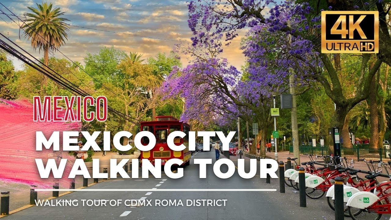
As you set off down Paseo de la Reforma, the wide avenue opens up, lined with towering buildings and lush greenery. The traffic gradually thickens, and you can hear the distant sounds of music and laughter as you pass by small parks. Turning onto Avenida Juárez, the scene shifts - smaller shops and cafés emerge, their aromas drawing you in. The landscape becomes more intimate, with people milling about, creating a cozy atmosphere. You’ll notice the change in light as you approach Bellas Artes, with its grand architecture illuminating your path.

Watch your step as you navigate the uneven cobblestones in some areas, especially near the historic buildings. The traffic can be intense, so stay alert at intersections. Keep an eye out for pickpockets in crowded areas, particularly around popular tourist spots. Language can be a barrier, but a smile and a few Spanish phrases often go a long way. Most shops and attractions have specific opening hours, so it’s wise to check ahead if you plan to stop along the way.

Make sure to wear comfortable walking shoes, as you’ll be covering a bit of ground. Bring plenty of water, especially if you’re walking during the warmer months. A light jacket might be necessary in the cooler evenings, while sunscreen will protect you from the midday sun. If you’re out early or late, the city takes on a different character, so plan your timing accordingly.

The best moment of this walk occurs as you reach Torre Latinoamericana just before sunset. The city begins to glow in warm hues, and you can see the lights flickering on as the sky darkens. Standing at the base, the air is filled with the sounds of laughter and the distant music from street performers, creating a perfect backdrop as the day transitions into night.

Turn-by-turn directions

14 steps · pace ~4.5 km/h
  1. Set off
    37 m
    29 s
  2. Take a left
    75 m
    1 min
    0.11 / 3.31 km · 3%
  3. 💧First quarter done. If it's hot, a sip of water now beats a gulp later.
  4. Hang a right
    Long stretch ahead - photo break, phone check, or just look around.
    933 m
    12 min
    1.04 / 3.31 km · 32%
  5. 🏁Halfway. Good moment to refill water or grab a quick coffee if you see one.
  6. Keep slight right at the fork
    Long stretch ahead - photo break, phone check, or just look around.
    705 m
    9 min
    1.75 / 3.31 km · 53%
  7. Take a left
    Long stretch ahead - photo break, phone check, or just look around.
    465 m
    6 min
    2.21 / 3.31 km · 67%
  8. Take a right onto Avenida de la República
    39 m
    32 s
    2.25 / 3.31 km · 68%
  9. Carry straight onto Avenida Paseo de la Reforma
    49 m
    39 s
    2.30 / 3.31 km · 70%
  10. Hang a right
    70 m
    56 s
    2.37 / 3.31 km · 72%
  11. 🪜Three quarters. Legs may start protesting - the next bench is fair game.
  12. Turn left onto Avenida Juárez
    Use this stretch to catch your breath if the next turn looks busy.
    288 m
    4 min
    2.66 / 3.31 km · 80%
  13. Turn left onto Calle Doctor Mora
    11 m
    9 s
    2.67 / 3.31 km · 81%
  14. 📍Almost there. Look up - you should be able to spot the destination soon.
  15. Hang a right
    Long stretch ahead - photo break, phone check, or just look around.
    468 m
    6 min
    3.14 / 3.31 km · 95%
  16. Turn left onto Avenida Juárez
    105 m
    1 min
    3.25 / 3.31 km · 98%
  17. Turn right onto Calle Francisco I. Madero
    Final stretch. Slow down so you don't walk past the entrance.
    64 m
    51 s
    3.31 / 3.31 km · 100%
  18. 🏁
    Arrive at destination

Local-script names show how they're signposted. The ≈ line shows a rough Latin transliteration to help with pronunciation. Times assume a steady ~5 km/h walk; add 15-20% in summer heat, on hills, or in crowds.

Open in the planner Customise this route or add more stops →
See Mexico City street previews

Watch Mexico City streets before you walk

Ambient first-person walking videos of Mexico City. Same streets, real sound. Pick a season or time-of-day to preview the route.

Watch Mexico City during the day
day · during the day
Watch Mexico City during the day
Watch Mexico City at night
night · at night
Watch Mexico City at night
Watch Mexico City in spring
spring · in spring
Watch Mexico City in spring
📏Just need the walking distance? See the distance page

Other walking routes in Mexico City

Share this route

WhatsAppTelegramFacebookXRedditLinkedInEmail

Frequently asked questions

How long does it take to walk from Angel of Independence to Torre Latinoamericana?

About 44 minutes at a steady 4.5 km/h walking pace. Add 15-20% in summer heat, on hills, or if you stop for photos.

How far is Angel of Independence from Torre Latinoamericana on foot?

The walking route is 3.31 km following pedestrian paths. The straight-line distance is shorter but ignores buildings and one-way streets.

Is this walk suitable for casual walkers?

This 3.31 km route is an moderate walk - manageable for most people in normal shoes. The pedestrian path uses footpaths and side streets where possible, so it's safer than walking along main roads.

What streets does the route pass through?

The route in Mexico City passes through Avenida de la República, Avenida Paseo de la Reforma, Avenida Juárez, Calle Doctor Mora and others. Street names are signposted in the local language.

What's the best time of day to walk this route?

For the best atmosphere on this stretch of Mexico City, the day walking video gives the most accurate preview of light and crowds. In general, early morning or sunset minimises midday heat and gives softer light for photos.

Is the walking route free?

Yes - planning, viewing the route, and using our directions are all free. Watch out for paid entry to any specific landmark on the route (museums, archaeological sites) - those are separate from the walk itself.

Can I reverse the route and walk from Torre Latinoamericana back to Angel of Independence?

Yes - the same path works in reverse with the same distance and walking time. Some one-way streets only affect drivers, not pedestrians.

Walking pace assumed at about 5 km/h on level ground - hills, crowds, and stops will slow you down.

Walking-route geometry from OpenStreetMap contributors via FOSSGIS OSRM (data licensed under ODbL). Landmark data from Wikidata (CC0).

·
Angel of IndependenceTorre Latinoamericana