Walking from National Palace to Angel of Independence

in Mexico City, Mexico

4.35 km
58 minutes walking
AB
National Palace
ANational PalaceWikidata ↗
Angel of Independence
BAngel of IndependenceWikidata ↗

Standing in front of the National Palace, you’re greeted by the imposing façade of this historic building. The air is thick with the smell of grilled tacos from nearby street vendors, blending with the scent of fresh flowers from a nearby market. You can hear the distant chatter of locals and the occasional honk from passing cars, creating a lively background. The sun casts long shadows, and you can feel the warmth on your skin as you prepare to set off on your walk.

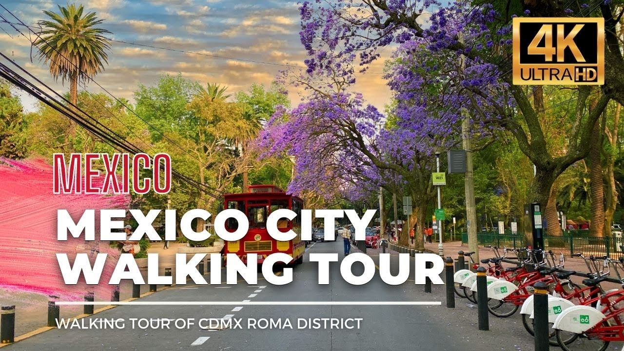
As you leave the palace, you’ll walk along Corregidora Street, where the city feels alive with activity. The surroundings shift from the grand architecture of the palace to the more intimate, narrow lanes of the Centro Histórico. You’ll pass through Plaza de la Constitución, where you can take in the enormous flag waving in the breeze. Continuing on, you’ll make your way up Avenida Juárez, where the atmosphere changes to a blend of trees and modern buildings, and you’ll hear the sound of artists performing in the street. The further you go, the more the urban density decreases, and the light shifts to a softer glow as you approach the lush greenery of Chapultepec Park.

Watch your step as you navigate the uneven cobblestones in the Centro Histórico; they can be tricky. Be aware of the traffic on Avenida Juárez, where cars, buses, and cyclists all share the road. It’s a good idea to keep your belongings secure, especially in busier areas where pickpockets may lurk. Many shops and attractions might have varying opening hours, so plan accordingly if you want to stop along the way.

Wear comfortable shoes since you'll be on your feet for almost an hour. Bring a bottle of water to stay hydrated, especially if you're walking during the warmer parts of the day. If you're out in the afternoon sun, a hat or sunscreen will help protect you from the heat. Conversely, if you're walking in the rainy season, an umbrella is essential.

The best moment of this walk comes as you reach the Angel of Independence at sunset. The golden light reflects off the statue, casting a warm glow across the plaza. You can hear the distant sound of mariachi music playing, blending with laughter and conversation as locals gather to enjoy the evening. The air is filled with the smell of street food, making it the perfect end to your journey.

Turn-by-turn directions

21 steps · pace ~4.5 km/h
  1. Set off
    116 m
    2 min
  2. Take a sharp left onto Calle Moneda
    Tight corner - watch for cyclists cutting it close.
    65 m
    52 s
    0.18 / 4.35 km · 4%
  3. Hang a right onto Plaza de la Constitución
    91 m
    1 min
    0.27 / 4.35 km · 6%
  4. Carry on along Plaza de la Constitución
    89 m
    1 min
    0.36 / 4.35 km · 8%
  5. 💧First quarter done. If it's hot, a sip of water now beats a gulp later.
  6. Take a slight right onto Calle Francisco I. Madero
    Long stretch ahead - photo break, phone check, or just look around.
    751 m
    10 min
    1.11 / 4.35 km · 26%
  7. Turn left onto Avenida Juárez
    116 m
    2 min
    1.23 / 4.35 km · 28%
  8. Take a left
    Long stretch ahead - photo break, phone check, or just look around.
    457 m
    6 min
    1.69 / 4.35 km · 39%
  9. Turn left onto Calle Doctor Mora
    11 m
    11 s
    1.70 / 4.35 km · 39%
  10. Take a right onto Avenida Juárez
    239 m
    3 min
    1.94 / 4.35 km · 44%
  11. Keep slight right onto Avenida Juárez at the fork
    48 m
    39 s
    1.98 / 4.35 km · 46%
  12. Hang a right
    70 m
    56 s
    2.05 / 4.35 km · 47%
  13. Take a left onto Avenida Paseo de la Reforma Norte
    49 m
    39 s
    2.10 / 4.35 km · 48%
  14. Carry straight onto Avenida de la República
    46 m
    37 s
    2.15 / 4.35 km · 49%
  15. 🏁Halfway. Good moment to refill water or grab a quick coffee if you see one.
  16. Hang a right
    Long stretch ahead - photo break, phone check, or just look around.
    458 m
    6 min
    2.61 / 4.35 km · 60%
  17. Hang a right
    Long stretch ahead - photo break, phone check, or just look around.
    560 m
    7 min
    3.17 / 4.35 km · 73%
  18. Keep slight left at the fork
    57 m
    46 s
    3.22 / 4.35 km · 74%
  19. 🪜Three quarters. Legs may start protesting - the next bench is fair game.
  20. Keep slight left at the fork
    Long stretch ahead - photo break, phone check, or just look around.
    684 m
    9 min
    3.91 / 4.35 km · 90%
  21. 📍Almost there. Look up - you should be able to spot the destination soon.
  22. Turn slight right
    Use this stretch to catch your breath if the next turn looks busy.
    359 m
    5 min
    4.27 / 4.35 km · 98%
  23. Hang a right
    54 m
    43 s
    4.32 / 4.35 km · 99%
  24. Turn right at the end of the road
    Final stretch. Slow down so you don't walk past the entrance.
    37 m
    29 s
    4.36 / 4.35 km · 100%
  25. 🏁
    Arrive at destination

Local-script names show how they're signposted. The ≈ line shows a rough Latin transliteration to help with pronunciation. Times assume a steady ~5 km/h walk; add 15-20% in summer heat, on hills, or in crowds.

Open in the planner Customise this route or add more stops →
See Mexico City street previews

Watch Mexico City streets before you walk

Ambient first-person walking videos of Mexico City. Same streets, real sound. Pick a season or time-of-day to preview the route.

Watch Mexico City during the day
day · during the day
Watch Mexico City during the day
Watch Mexico City at night
night · at night
Watch Mexico City at night
Watch Mexico City in spring
spring · in spring
Watch Mexico City in spring

Other walking routes in Mexico City

Share this route

WhatsAppTelegramFacebookXRedditLinkedInEmail

Frequently asked questions

How long does it take to walk from National Palace to Angel of Independence?

About 58 minutes at a steady 4.5 km/h walking pace. Add 15-20% in summer heat, on hills, or if you stop for photos.

How far is National Palace from Angel of Independence on foot?

The walking route is 4.35 km following pedestrian paths. The straight-line distance is shorter but ignores buildings and one-way streets.

Is this walk suitable for casual walkers?

This 4.35 km route is an longer walk - bring water and pace yourself. The pedestrian path uses footpaths and side streets where possible, so it's safer than walking along main roads.

What streets does the route pass through?

The route in Mexico City passes through Calle Moneda, Plaza de la Constitución, Calle Francisco I. Madero, Avenida Juárez and others. Street names are signposted in the local language.

What's the best time of day to walk this route?

For the best atmosphere on this stretch of Mexico City, the day walking video gives the most accurate preview of light and crowds. In general, early morning or sunset minimises midday heat and gives softer light for photos.

Is the walking route free?

Yes - planning, viewing the route, and using our directions are all free. Watch out for paid entry to any specific landmark on the route (museums, archaeological sites) - those are separate from the walk itself.

Can I reverse the route and walk from Angel of Independence back to National Palace?

Yes - the same path works in reverse with the same distance and walking time. Some one-way streets only affect drivers, not pedestrians.

Walking pace assumed at about 5 km/h on level ground - hills, crowds, and stops will slow you down.

Walking-route geometry from OpenStreetMap contributors via FOSSGIS OSRM (data licensed under ODbL). Landmark data from Wikidata (CC0).