enesfrdeitpt

Walking from India Tower to Mumba Devi Temple

in Victorian Gothic and Art Deco Ensembles of Mumbai, India

1.22 km
16 minutes walking
AB
India Tower
AIndia TowerWikidata ↗
Mumba Devi Temple
BMumba Devi TempleWikidata ↗

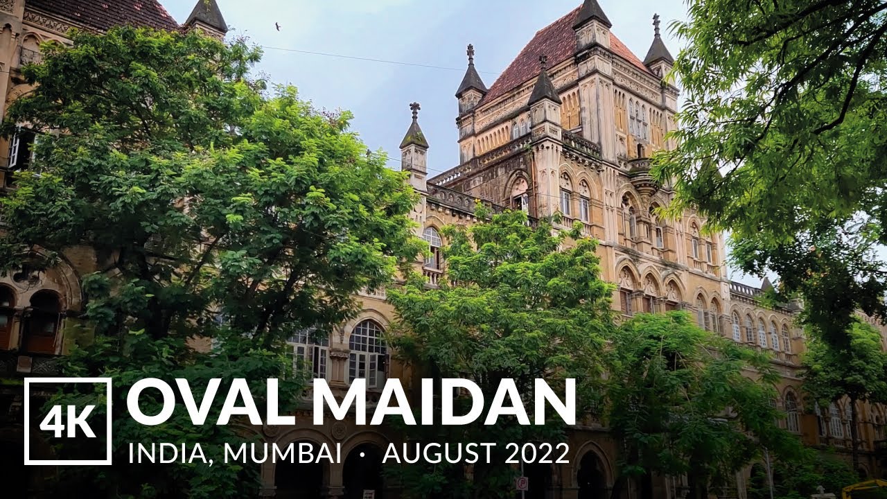
Standing at India Tower, the air hums with a mix of anticipation and the faint scent of spices wafting from nearby food stalls. The towering structure looms above, its intricate design a nod to the city’s colonial past. You can hear the chatter of passersby and the distant honk of rickshaws weaving through traffic. The warmth of the sun bathes the area, and you can’t help but feel the pulse of Mumbai surrounding you.

As you set off along Veer Nariman Road, the atmosphere gradually shifts. The road widens, and the sounds of the city come alive - vendors shouting their wares, the click of heels on the pavement, and the rustling of paper from nearby kiosks. You’ll notice the transition as you approach the intersection with Bhuleshwar Road, where the architecture morphs from the grandeur of Victorian Gothic to the geometric lines of Art Deco. The streets become narrower and more crowded, filled with the scent of street food, particularly the fried snacks sold from small carts.

Keep an eye out for the uneven cobblestones as you traverse Bhuleshwar Road; they can be tricky underfoot. Traffic can be chaotic, so be cautious when crossing the streets. It's best to avoid peak hours, as the sidewalks fill with people and vehicles alike. Watch for pickpockets in crowded areas, especially near the temple, where tourists often gather. Most shops and stalls are open late, but some temples may have specific visiting hours, so plan accordingly.

Wear comfortable shoes for this walk, as you’ll be navigating uneven terrain and possibly encountering some mud if it rains. Carry a bottle of water to stay hydrated, and consider bringing a light jacket if you're walking in the evening - Mumbai can get breezy once the sun sets. If you're out during the monsoon, a waterproof cover for your bag is wise.

The best moment on this route comes as you approach Mumba Devi Temple just before sunset. The golden hour casts a warm glow over the temple's intricately carved facade, and the sounds of evening prayers fill the air. You can feel the energy shift as the day transitions into night, the lights flickering on around you, while the scent of incense mingles with the lingering aroma of street food.

Turn-by-turn directions

10 steps · pace ~4.5 km/h
  1. Set off
    67 m
    54 s
  2. Hang a slight left
    180 m
    2 min
    0.25 / 1.22 km · 20%
  3. 💧First quarter done. If it's hot, a sip of water now beats a gulp later.
  4. Hang a right
    298 m
    4 min
    0.55 / 1.22 km · 45%
  5. 🏁Halfway. Good moment to refill water or grab a quick coffee if you see one.
  6. Turn left onto Dadiseth Agyari Lane
    211 m
    3 min
    0.76 / 1.22 km · 62%
  7. Hang a right
    89 m
    1 min
    0.84 / 1.22 km · 69%
  8. 🪜Three quarters. Legs may start protesting - the next bench is fair game.
  9. Take a left
    187 m
    3 min
    1.03 / 1.22 km · 84%
  10. Turn right onto Kalbadevi Road at the end of the road
    39 m
    31 s
    1.07 / 1.22 km · 88%
  11. 📍Almost there. Look up - you should be able to spot the destination soon.
  12. Take a left
    122 m
    2 min
    1.19 / 1.22 km · 98%
  13. Hang a right
    Final stretch. Slow down so you don't walk past the entrance.
    28 m
    23 s
    1.22 / 1.22 km · 100%
  14. 🏁
    Arrive at destination

Local-script names show how they're signposted. The ≈ line shows a rough Latin transliteration to help with pronunciation. Times assume a steady ~5 km/h walk; add 15-20% in summer heat, on hills, or in crowds.

Open in the planner Customise this route or add more stops →
See Victorian Gothic and Art Deco Ensembles of Mumbai street previews

Watch Victorian Gothic and Art Deco Ensembles of Mumbai streets before you walk

Ambient first-person walking videos of Victorian Gothic and Art Deco Ensembles of Mumbai. Same streets, real sound. Pick a season or time-of-day to preview the route.

Watch Victorian Gothic and Art Deco Ensembles of Mumbai during the day
day · during the day
Watch Victorian Gothic and Art Deco Ensembles of Mumbai during the day

Other walking routes in Victorian Gothic and Art Deco Ensembles of Mumbai

Share this route

WhatsAppTelegramFacebookXRedditLinkedInEmail

Frequently asked questions

How long does it take to walk from India Tower to Mumba Devi Temple?

About 16 minutes at a steady 4.5 km/h walking pace. Add 15-20% in summer heat, on hills, or if you stop for photos.

How far is India Tower from Mumba Devi Temple on foot?

The walking route is 1.22 km following pedestrian paths. The straight-line distance is shorter but ignores buildings and one-way streets.

Is this walk suitable for casual walkers?

This 1.22 km route is an easy stroll suitable for most fitness levels. The pedestrian path uses footpaths and side streets where possible, so it's safer than walking along main roads.

What streets does the route pass through?

The route in Victorian Gothic and Art Deco Ensembles of Mumbai passes through Dadiseth Agyari Lane, Kalbadevi Road. Street names are signposted in the local language.

What's the best time of day to walk this route?

For the best atmosphere on this stretch of Victorian Gothic and Art Deco Ensembles of Mumbai, the day walking video gives the most accurate preview of light and crowds. In general, early morning or sunset minimises midday heat and gives softer light for photos.

Is the walking route free?

Yes - planning, viewing the route, and using our directions are all free. Watch out for paid entry to any specific landmark on the route (museums, archaeological sites) - those are separate from the walk itself.

Can I reverse the route and walk from Mumba Devi Temple back to India Tower?

Yes - the same path works in reverse with the same distance and walking time. Some one-way streets only affect drivers, not pedestrians.

Walking pace assumed at about 5 km/h on level ground - hills, crowds, and stops will slow you down.

Walking-route geometry from OpenStreetMap contributors via FOSSGIS OSRM (data licensed under ODbL). Landmark data from Wikidata (CC0).