Walking from Gyeongbokgung to Namsan Seoul Tower

in Seoul, South Korea

4.50 km
60 minutes walking
AB
Gyeongbokgung
AGyeongbokgungWikidata ↗
BNamsan Seoul TowerWikidata ↗

Standing in front of Gyeongbokgung Palace, the air is crisp with a hint of pine from the nearby trees. You can hear the soft rustle of leaves and the distant chatter of tourists. The intricate details of the palace's architecture draw your gaze, while the warm sun bathes everything in a golden light. As you take a deep breath, the fragrance of street food wafts over from a nearby vendor, promising a delicious treat for later.

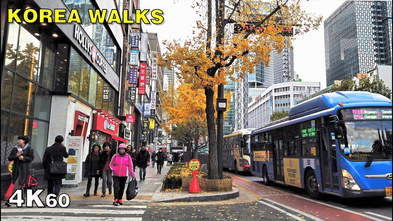
As you begin your walk, head down Sejong-daero, where the landscape shifts from the regal grounds of the palace to the lively streets of the city. You’ll notice the density increase; high-rise buildings loom over you, and the sounds of honking cars fill the air. The aroma of sizzling tteokbokki and fried snacks from street stalls becomes more pronounced. You’ll pass through Gwanghwamun Square, where locals gather and street performers often showcase their talents. Continuing along the bustling streets of Myeongdong, the atmosphere morphs into a whirlwind of neon signs and shoppers, all while the scent of sweet pastries lingers in the cool breeze.

Keep an eye out for uneven cobblestones, especially as you navigate through the narrower streets of Myeongdong. The pedestrian traffic can be thick, with people darting in and out of shops, so watch your step. There's a chance you might encounter some aggressive sales pitches from street vendors, so it's best to stay focused. If you're taking photos, be mindful of pickpockets, especially in crowded areas. Most shops and attractions have varying opening hours, so if you're planning to explore later, confirm ahead of time.

For this walk, wear comfortable shoes since you’ll be on your feet for about an hour. Bring a bottle of water to stay hydrated, especially in warmer months. Depending on the season, a light jacket might be useful for cooler evenings. If you're walking in the afternoon, sunscreen could be a good idea, as you’ll be exposed to the sun along the way.

The best moment comes as you ascend Namsan. Just before reaching the tower, take a moment to pause and look out over the sprawling cityscape. The sunset paints the horizon in shades of orange and pink, while the gentle hum of the city below blends with the rustling leaves around you. It’s a moment of tranquility amidst the urban buzz, and you can feel the day winding down as the lights begin to twinkle on.

Turn-by-turn directions

38 steps · pace ~4.5 km/h
  1. Set off
    10 m
    8 s
  2. Take a left
    27 m
    22 s
    0.04 / 4.50 km · 1%
  3. Hang a right
    113 m
    2 min
    0.15 / 4.50 km · 3%
  4. Take a left
    55 m
    44 s
    0.20 / 4.50 km · 5%
  5. Take a left
    31 m
    24 s
    0.24 / 4.50 km · 5%
  6. Turn left at the end of the road
    96 m
    1 min
    0.33 / 4.50 km · 7%
  7. Take a left
    135 m
    2 min
    0.47 / 4.50 km · 10%
  8. Take a left
    116 m
    2 min
    0.58 / 4.50 km · 13%
  9. Hang a right
    38 m
    31 s
    0.62 / 4.50 km · 14%
  10. Hang a right
    103 m
    1 min
    0.72 / 4.50 km · 16%
  11. 💧First quarter done. If it's hot, a sip of water now beats a gulp later.
  12. Turn left onto 광화문광장
    Long stretch ahead - photo break, phone check, or just look around.
    503 m
    7 min
    1.23 / 4.50 km · 27%
  13. Turn left at the end of the road
    41 m
    33 s
    1.27 / 4.50 km · 28%
  14. Hang a right
    35 m
    28 s
    1.30 / 4.50 km · 29%
  15. Turn left at the end of the road
    364 m
    5 min
    1.67 / 4.50 km · 37%
  16. Turn right at the end of the road
    91 m
    1 min
    1.76 / 4.50 km · 39%
  17. Take a left
    32 m
    25 s
    1.79 / 4.50 km · 40%
  18. Hang a right
    56 m
    45 s
    1.85 / 4.50 km · 41%
  19. Hang a right
    65 m
    52 s
    1.91 / 4.50 km · 43%
  20. Hang a right
    52 m
    41 s
    1.96 / 4.50 km · 44%
  21. 🏁Halfway. Good moment to refill water or grab a quick coffee if you see one.
  22. Turn slight right
    320 m
    4 min
    2.28 / 4.50 km · 51%
  23. Turn slight right
    137 m
    2 min
    2.42 / 4.50 km · 54%
  24. Turn slight right
    25 m
    20 s
    2.44 / 4.50 km · 54%
  25. Turn right onto 남대문로
    4 m
    3 s
    2.45 / 4.50 km · 54%
  26. Take a left
    36 m
    28 s
    2.48 / 4.50 km · 55%
  27. Take a left onto 소월로
    144 m
    2 min
    2.63 / 4.50 km · 58%
  28. Hang a left onto 남대문시장4길
    15 m
    12 s
    2.64 / 4.50 km · 59%
  29. Hang a right onto 서울한양도성 3코스 남산구간
    51 m
    40 s
    2.69 / 4.50 km · 60%
  30. Turn right onto 서울한양도성 3코스 남산구간 at the end of the road
    Long stretch ahead - photo break, phone check, or just look around.
    572 m
    8 min
    3.27 / 4.50 km · 73%
  31. Keep slight left at the fork
    51 m
    41 s
    3.32 / 4.50 km · 74%
  32. Turn slight right
    45 m
    36 s
    3.36 / 4.50 km · 75%
  33. 🪜Three quarters. Legs may start protesting - the next bench is fair game.
  34. Hang a right
    28 m
    22 s
    3.39 / 4.50 km · 75%
  35. Take a left onto 서울한양도성 3코스 남산구간
    85 m
    1 min
    3.48 / 4.50 km · 77%
  36. Take a left
    96 m
    1 min
    3.57 / 4.50 km · 79%
  37. Hang a right
    163 m
    2 min
    3.73 / 4.50 km · 83%
  38. 📍Almost there. Look up - you should be able to spot the destination soon.
  39. Hang a right onto 서울한양도성 3코스 남산구간
    Use this stretch to catch your breath if the next turn looks busy.
    331 m
    4 min
    4.07 / 4.50 km · 90%
  40. Carry on along 서울한양도성 3코스 남산구간
    Use this stretch to catch your breath if the next turn looks busy.
    373 m
    5 min
    4.44 / 4.50 km · 99%
  41. Hang a right
    Final stretch. Slow down so you don't walk past the entrance.
    63 m
    50 s
    4.50 / 4.50 km · 100%
  42. 🏁
    Arrive at destination

Local-script names show how they're signposted. The ≈ line shows a rough Latin transliteration to help with pronunciation. Times assume a steady ~5 km/h walk; add 15-20% in summer heat, on hills, or in crowds.

Open in the planner Customise this route or add more stops →
See Seoul street previews

Watch Seoul streets before you walk

Ambient first-person walking videos of Seoul. Same streets, real sound. Pick a season or time-of-day to preview the route.

Watch Seoul during the day
day · during the day
Watch Seoul during the day
Watch Seoul at night
night · at night
Watch Seoul at night
Watch Seoul in spring
spring · in spring
Watch Seoul in spring

Other walking routes in Seoul

Share this route

WhatsAppTelegramFacebookXRedditLinkedInEmail

Frequently asked questions

How long does it take to walk from Gyeongbokgung to Namsan Seoul Tower?

About 60 minutes at a steady 4.5 km/h walking pace. Add 15-20% in summer heat, on hills, or if you stop for photos.

How far is Gyeongbokgung from Namsan Seoul Tower on foot?

The walking route is 4.50 km following pedestrian paths. The straight-line distance is shorter but ignores buildings and one-way streets.

Is this walk suitable for casual walkers?

This 4.50 km route is an longer walk - bring water and pace yourself. The pedestrian path uses footpaths and side streets where possible, so it's safer than walking along main roads.

What streets does the route pass through?

The route in Seoul passes through 광화문광장, 남대문로, 소월로, 남대문시장4길 and others. Street names are signposted in the local language.

What's the best time of day to walk this route?

For the best atmosphere on this stretch of Seoul, the day walking video gives the most accurate preview of light and crowds. In general, early morning or sunset minimises midday heat and gives softer light for photos.

Is the walking route free?

Yes - planning, viewing the route, and using our directions are all free. Watch out for paid entry to any specific landmark on the route (museums, archaeological sites) - those are separate from the walk itself.

Can I reverse the route and walk from Namsan Seoul Tower back to Gyeongbokgung?

Yes - the same path works in reverse with the same distance and walking time. Some one-way streets only affect drivers, not pedestrians.

Walking pace assumed at about 5 km/h on level ground - hills, crowds, and stops will slow you down.

Walking-route geometry from OpenStreetMap contributors via FOSSGIS OSRM (data licensed under ODbL). Landmark data from Wikidata (CC0).