Walking from St. Michael's Church to The Capital
in Mumbai, India


Turn-by-turn directions
- ▶Set off along Lady Jamshedji Road286 m4 min
- ↱Take a right onto SL Raheja Hospital Marg13 m11 s0.30 / 4.78 km · 6%
- ↰Take a left286 m4 min0.58 / 4.78 km · 12%
- ↰Take a left54 m43 s0.64 / 4.78 km · 13%
- ↱Hang a right129 m2 min0.77 / 4.78 km · 16%
- ↱Take a right onto Mahim Causeway76 m1 min0.84 / 4.78 km · 18%
- 💧First quarter done. If it's hot, a sip of water now beats a gulp later.
- ↑Road becomes Swami Vivekanand Road394 m5 min1.24 / 4.78 km · 26%
- ↱Hang a right313 m4 min1.55 / 4.78 km · 32%
- ↖Hang a slight left127 m2 min1.68 / 4.78 km · 35%
- ↱Turn right onto Gurunanak Marg (Turner Road)142 m2 min1.82 / 4.78 km · 38%
- ↖Hang a slight left103 m1 min1.92 / 4.78 km · 40%
- ↰Hang a left onto Bandra Station Path63 m51 s1.99 / 4.78 km · 42%
- ↱Turn right onto 30th Cross Road at the end of the road105 m1 min2.09 / 4.78 km · 44%
- 🏁Halfway. Good moment to refill water or grab a quick coffee if you see one.
- ↖Keep slight left onto Kherwadi Road at the forkLong stretch ahead - photo break, phone check, or just look around.472 m6 min2.56 / 4.78 km · 54%
- ↱Hang a right onto Road No 885 m1 min2.65 / 4.78 km · 55%
- ↰Take a left140 m2 min2.79 / 4.78 km · 58%
- ↱Turn right onto Ram Mandir Road at the end of the road190 m3 min2.98 / 4.78 km · 62%
- ↑Road becomes S D Mandir Marg164 m2 min3.14 / 4.78 km · 66%
- ↖Keep slight left onto S D Mandir Marg at the fork137 m2 min3.28 / 4.78 km · 69%
- ↰Turn left onto Ambedkar Chowk106 m1 min3.38 / 4.78 km · 71%
- ↰Take a left176 m2 min3.56 / 4.78 km · 74%
- 🪜Three quarters. Legs may start protesting - the next bench is fair game.
- ↱Turn right at the end of the road103 m1 min3.66 / 4.78 km · 77%
- ↰Hang a left onto Ramakrishna Paramahansa Marg187 m3 min3.85 / 4.78 km · 81%
- ↖Keep slight left onto Ramakrishna Paramahansa Marg at the fork65 m52 s3.92 / 4.78 km · 82%
- ↰Take a left74 m59 s3.99 / 4.78 km · 83%
- ↱Hang a right203 m3 min4.19 / 4.78 km · 88%
- ↱Hang a right30 m24 s4.22 / 4.78 km · 88%
- ↰Take a left74 m59 s4.30 / 4.78 km · 90%
- 📍Almost there. Look up - you should be able to spot the destination soon.
- ↱Hang a right28 m23 s4.33 / 4.78 km · 90%
- ↰Take a left128 m2 min4.45 / 4.78 km · 93%
- ↱Turn right at the end of the road131 m2 min4.58 / 4.78 km · 96%
- ↰Take a leftFinal stretch. Slow down so you don't walk past the entrance.197 m3 min4.78 / 4.78 km · 100%
- 🏁Arrive at destination
Local-script names show how they're signposted. The ≈ line shows a rough Latin transliteration to help with pronunciation. Times assume a steady ~5 km/h walk; add 15-20% in summer heat, on hills, or in crowds.
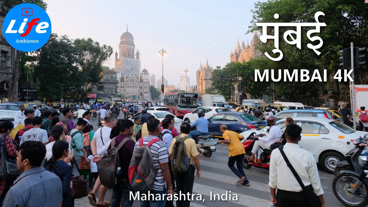
Watch Mumbai streets before you walk
Ambient first-person walking videos of Mumbai. Same streets, real sound. Pick a season or time-of-day to preview the route.


Other walking routes in Mumbai
- St. Michael's Church → Sacred Heart Church, Santacruz4.3 km
- St. Michael's Church → Ghanteshwar Temple Mumbai3.6 km
- Holy Cross Church, Kurla → Our Lady of Egypt Church2.7 km
- Our Lady of Egypt Church → Sacred Heart Church, Santacruz4.1 km
- Our Lady of Egypt Church → Ghanteshwar Temple Mumbai4.7 km
- Sacred Heart Church, Santacruz → Ghanteshwar Temple Mumbai0.6 km
- Our Lady of Egypt Church → The Capital3.7 km
- Sacred Heart Church, Santacruz → The Capital4.1 km
Frequently asked questions
›How long does it take to walk from St. Michael's Church to The Capital?
About 64 minutes at a steady 4.5 km/h walking pace. Add 15-20% in summer heat, on hills, or if you stop for photos.
›How far is St. Michael's Church from The Capital on foot?
The walking route is 4.78 km following pedestrian paths. The straight-line distance is shorter but ignores buildings and one-way streets.
›Is this walk suitable for casual walkers?
This 4.78 km route is an longer walk - bring water and pace yourself. The pedestrian path uses footpaths and side streets where possible, so it's safer than walking along main roads.
›What streets does the route pass through?
The route in Mumbai passes through Lady Jamshedji Road, SL Raheja Hospital Marg, Mahim Causeway, Swami Vivekanand Road and others. Street names are signposted in the local language.
›What's the best time of day to walk this route?
For the best atmosphere on this stretch of Mumbai, the day walking video gives the most accurate preview of light and crowds. In general, early morning or sunset minimises midday heat and gives softer light for photos.
›Is the walking route free?
Yes - planning, viewing the route, and using our directions are all free. Watch out for paid entry to any specific landmark on the route (museums, archaeological sites) - those are separate from the walk itself.
›Can I reverse the route and walk from The Capital back to St. Michael's Church?
Yes - the same path works in reverse with the same distance and walking time. Some one-way streets only affect drivers, not pedestrians.
Walking pace assumed at about 5 km/h on level ground - hills, crowds, and stops will slow you down.
Walking-route geometry from OpenStreetMap contributors via FOSSGIS OSRM (data licensed under ODbL). Landmark data from Wikidata (CC0).
